Lake Powell, named after explorer John Wesley Powell (one armed American Civil War veteran), straddles the border of Utah and Arizona. It formed after the Colorado River (with the Escalante, Dirty Devil, and San Juan River tributaries) was dammed by the Glen Canyon Dam, starting with construction in 1956-1963. It is the younger sister to Lake Mead, stored behind the Hoover Dam. Lake Powell reached it's peak capacity in 1983, but has not been quite that full since. The Dam is over 700 feet tall, and generates hydroelectricity primarily for Southern California. The lake and surroundings are now known as the Glen Canyon National Recreational Area, and includes over 90 side canyons and parts of Cataract Canyon on the Green River. Over 2 million people visit and use the lake for recreation annually.
For those of you newly added to this blog, please look back to earlier entries on this Bluff, UT area trip for context. Most earlier blog photos were taken with a Samsung cell phone, though these were captured with a DSLR Nikon or Fujifilm.

On a tranquil, sunny day in late May, Paul and I took off from the Bluff, UT airstrip in his ultralight to fly northwest through the skies over Lake Powell.

A bright, clear, calm morning test take off from Bluff, shortly after sunrise.

Remnants of mist linger over the San Juan River.

The Mule Ears landmark along Comb Ridge.

As we head north and east, the buttes of Monument Valley peek above the morning mist.

Clouds creep over the edge of the Colorado Plateau into the lower canyons.

The San Juan straightens out briefly as it cuts through the Wingate Sandstone.

Navajo Mtn. in the distance. The lake used to form this far up the San Juan, creating a verdant little valley.

Current upper reaches of Lake Powell revealing shallow areas and sand bars.

Deeper water and lazy bends of the San Juan, exposing the visible "bathtub ring", marking the previous high water line.

Closer view of the sacred Navajo Mountain, just inside Utah border north of AZ.
Interesting shapes form from the water-etched channels.

Boaters explore the Lake Powell twists and turns.

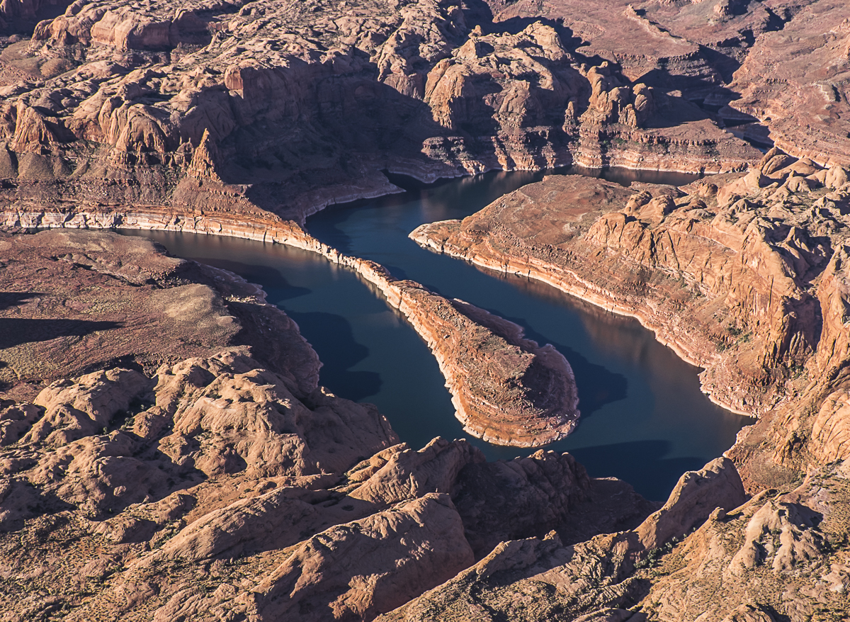
More curves and channels.

Meandering toward the main body of the Lake.

Deep blue waters and towering red rock cliffs of the main lake.

Lots of unusual sandstone formations. I see alligator forms on the mid-right.

Crevice in shadow is the famous Hole-in-the-Rock passage, utilized by Mormon settlers descending to the canyon floor...before the lake formed.

Houseboat beached in a solitary side canyon.

Rocky convolutions looking downstream.

Broader reach of the main Lake Powell.

Blue skies and blue waters.

Approaching Bullfrog Bay, with still water reflections.

Hall's Crossing and marina, with the Charles Hall Ferry (mid-channel) linking the north/south sides of Hwy 276.


Heading back to the southeast, viewing Monument Valley with lifting clouds.

Promontory of plateau, looking like a giant's Lego game, near Muley Point overlook.

Edge of plateau near the Moki Dugway roadway descent and Muley Point overlook, with wingtip of ultralight.

View from the south side of Valley of the Gods.

Seven Sailors formation in Valley of the Gods.

Tiny oasis of emerald green nestled in the desert.

Uplifted serrations just west of Comb Ridge, lining top of photo.

Escarpment of Comb Ridge, looking north and west.

Back "home" to Bluff airstrip with RV & car parked near hangar.

My shadow and me - cast by ultralight sailing over the desert floor.
Thanks for joining us on this armchair adventure in, around and over Bluff, UT. Be well and be safe until next time.
No comments:
Post a Comment